BAKERS HILL
Originally gazetted as Mount Baker in 1897, the name was changed to Baker’s Hill in 1902 to avoid confusion with Mount Barker. While the apostrophe in the name was not dropped until 1944. It is believed to be named after an early settler in the area, John or James Baker.
Amenities: Bakers Hill Pie Shop, Bakers Hill Primary School & Bakers Hill Recreation Centre
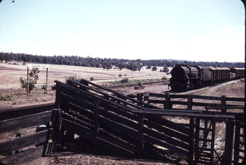
Bakers Hill Railway Station – January 1966
Image: Weston Langford
CHIDLOW
Once the terminus for the Eastern Railway with early settlement in the area beginning in 1883. The town was named Chidlow’s Well after a pioneering family of Northam and the small waterhole beside the Old Northam Road. Chidlow’s Well was renamed Chidlow in 1920.
Amenities: Chidlow Recreation Ground, Chidlow Primary School, Chidlow Tavern, Lake Leschenaultia and The Bay Tree Bakery & Café.
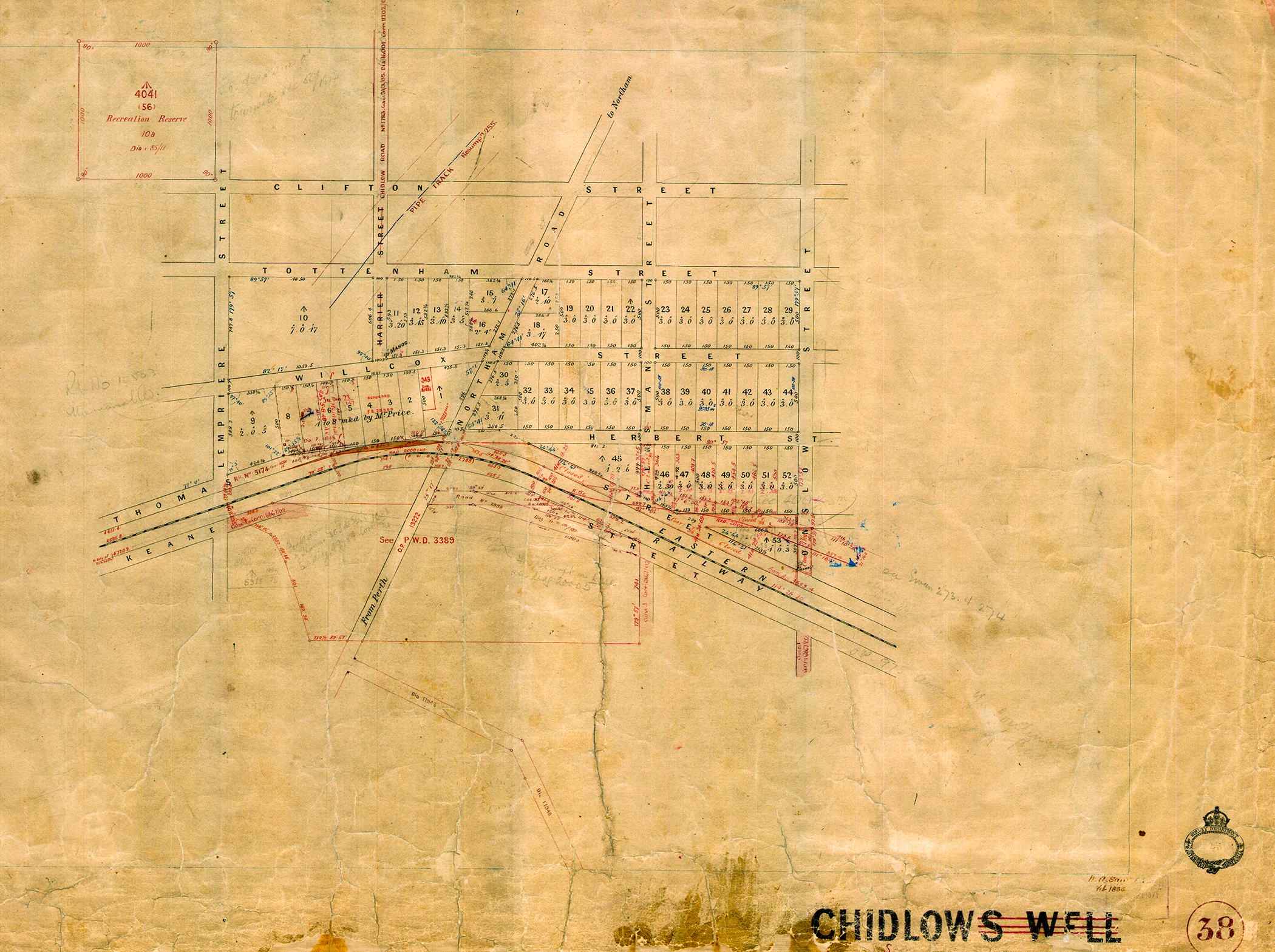
Early subdivision plan of Chidlow’s Well
Image: State Records Office of WA
FORRESTFIELD
Local folklore suggests that the name, Forrestfield comes from Charles Hale who first settled in the area back in 1902. Mr Hale planted a crop amongst the trees and a neighbour referred to him wanting a forest and a field at the same time. While there is another suggestion that the name honours John or Alexander Forrest who have no known connection to the area. Forrestfield first began appearing on plans of the area in 1944.
Amenities: Darling Range Sports College, Dawson Park, Dawson Park Primary School, Edinburgh Road Shopping Centre, Forrestfield Forum & Marketplace Shopping Centre, Forrestfield Primary School, Hale Road Tavern, Hartfield Golf Club, Hartfield Park, Hillside Christian College, Heritage College, Lesmurdie Falls National Park, Mead Medical Group, Perth Tourist Caravan Park & Woodlupine Primary School.
MIDLAND
Midland takes its name from the Midland Railway Company of Western Australia. The company was contracted in 1886 by the State Government to build a railway line from Midland to Walkaway in return for land grants.
Midland Railway Company of Western Australia established its headquarters on the site of what is now the Centrepoint Midland Shopping Centre from it a township grew.
By 1895, the municipality of Helena Vale was proclaimed and in 1901, Helena Vale became Midland Junction. The State Government relocated its own railway workshops from Fremantle to Midland Junction in 1904. Midland Junction became Midland in 1961.
Amenities: Carnegie Gardens, Centrepoint Midland Shopping Centre, City of Swan Administration Centre, Commercial Tavern, Corti Park, GP Superclinic @ Workshops, Grand Central Hotel, Juniper Gardens, Koolbardi Park, Landgate, Midland Bus & Train Station, Midland Central, Midland Gate Shopping Centre, Midland Public Library, Midland Town Hall, Railway Square, The 7th Avenue Bar & Restaurant, The Principal Bar & Restaurant, St Andrews Medical Centre, St John of God Midland Public & Private Hospital, Swan Medical Centre & Warnock Park.
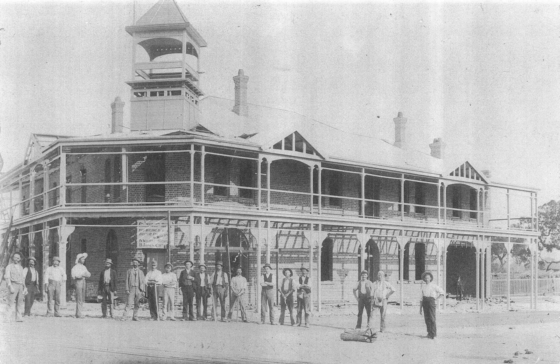
Freemasons Hotel in Helena Vale under construction in 1896.
Image: City of Swan Local History Collection
MUNDARING
Early settlers began arriving in the area between 1882 and 1884. One of them was Peter Gugeri who established the first vineyard south of the Eastern Railway. Mathieson Jacoby took over Gugeri’s vineyards in 1893 and renamed the business, Mundaring Vineyard Company.
The name ‘Mundaring’ came from a nearby Aboriginal camp and means ‘a high place on a high place’.
Amenities: Albert Facey Memorial Library, Beelu National Park, Black Cockatoo Park, Harry Riseborough Oval, Lions Park, Little Caesars Pizzeria, Mundaring Arts Centre, Mundaring Christian College, Mundaring Hotel, Mundaring Primary School, Mundaring Recreation Ground, Mundaring Sculpture Park, Mundaring Village Shopping Centre, Mundaring Visitors Centre, Mundaring Weir, Mundaring Weir Hotel, Number 1 Pump Station Museum, Sacred Heart Catholic Primary School, Shire of Mundaring Administration Centre & The Ming Restaurant.
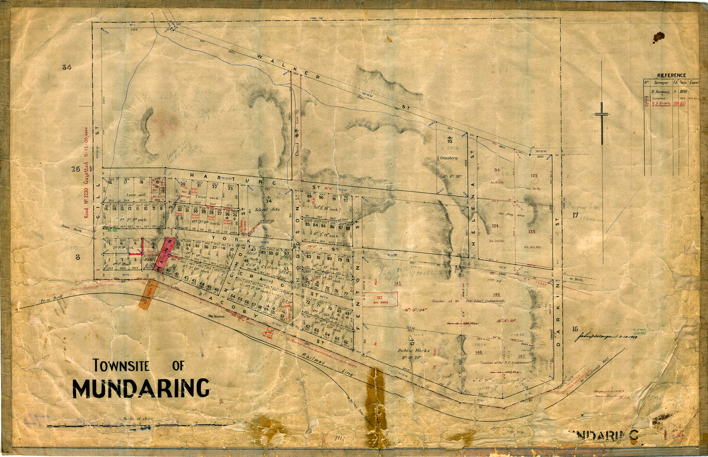
Early subdivision plan of Mundaring
Image: State Records Office of WA